Urban Pressure & Spatial Measures
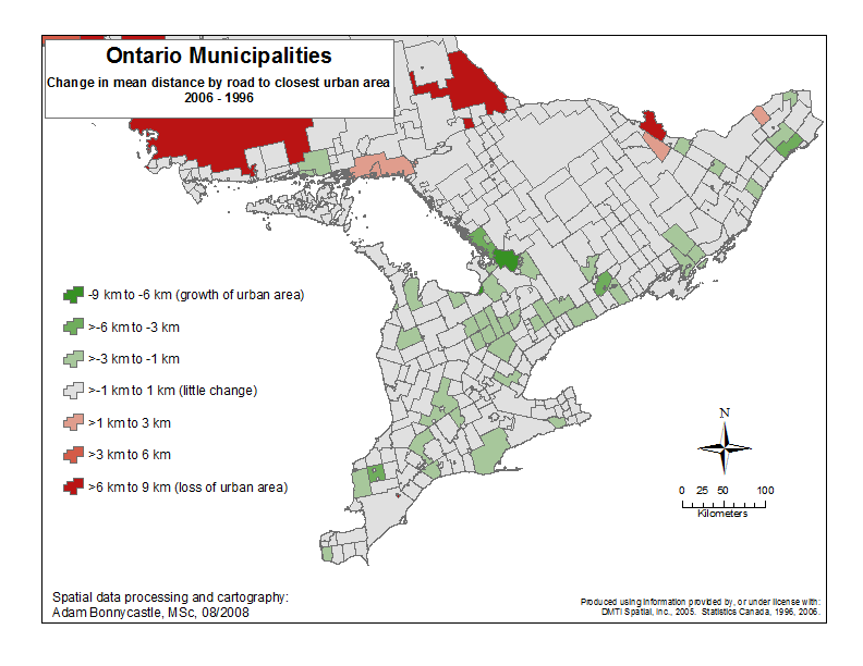
Understanding and anticipating change in rural areas is essential to implementing effective policy regarding rural and urbanizing areas. This research project sought to develop appropriate variables for measuring urban pressure on rural communities. Researchers worked with available datasets from Statistics Canada urban areas data and DMTI Spatial road network data, GIS and remote sensing technologies, and temporal resolution for the census years 1996, 2001, and 2006. Using GIS we calculated the distance by road from each municipality to the closest urban area.
Emerging themes from this project include:
- Physical urban growth in Ontario is not evenly distributed, spatially or temporally, even around densely populated regions such as the GTA.
- Measuring distance by road may be superior to typical straight line measurements, especially around features such as the great lakes.
- Geomatics technologies show promise for assessing urban growth and pressures on rural areas. Remotely sensed imagery may prove useful for these types of analyses if efficient methods to process large areas are developed.
Paper Presentation:
"Measuring Urban Pressure on Rural Communities"
Adam Bonnycastle and Brady Deaton
December 2008
Data for Ontario Municipalities:
Distance to Toronto
Distance to Urban Areas
Click on map for closer view of that area.
OMAFRA: Sustainable Rural Communities Research Program